Showing posts with label Trails: Los Pinos. Show all posts

Sunday, March 30, 2008

Into the clouds

We ran Los Pinos trail again today – this time with Kirk. No one else showed up. And this is very understandable: the weather was pretty nasty in the morning – it was cold and drizzling. I barely managed to suppress a temptation to go back to bad when I opened the door this morning.
We started from Lazy W Ranch, ran all the way to the Main Divide and then back.
~ Overall elevation gain: about 5,000ft
~ Total mileage: 17.5 miles
~ Our time today: 5:19:05 (this does not include our pit stops)
It was raining, but not as windy as the last time. I got wet through pretty quickly, as the trail is overgrown and you cannot run through these bushes without getting completely soaked with all the water from them.
After mile 4 it got pretty dark as we ran into a cloud. It felt like a sauna, except it was a way colder.
Even despite the weather condition we could not help noticing on our way up – through the tears – that the trail is freaking beautiful as everything was blooming on it.
On our way back we got passed by three mountain bikers. Should I add they were actually biking three, on those steep ridge trails? I am getting goose bumps on my back from just thinking about trying to ride a bike on the Los Pinos trail!
More photos from our run:

Los Pinos: into the clouds

Wednesday, March 26, 2008

Los Pinos: directions to Lazy W trailhead


Access:
The upper trailhead is on North Main Divide road 5.8 miles from Ortega Highway (Hwy 74). The lower trailhead is in Hot Springs Canyon, 1.5 miles beyond the San Juan Fire Station off the Ortega Highway on the Lazy W Ranch. Trail ends on private property.

The Forest Service guidelines suggest you should call the Lazy W Ranch in advance of visit for permission to cross their property, but Lambert and Greg say that as soon as you park on Lazy W parking lot (which is not private) you can just walk through without any prior arrangements and no one will get offended.

Coordinates:
+33° 36' 6.39", -117° 30' 37.55" (33.601775, -117.510431)
If you post it in Google Maps, it will show you an approximate location of the Lazy W trailhead parking. You need an Adventure Pass to be able to park there.

Maps:

View Larger Map


Note:
The parking is a bit tricky to find. After you turn from Ortega Hwy onto Hot Springs Canyon Rd, you will need to drive up about a mile to the parking lot. The parking lot will be on your right under a bunch of trees. There will be a small rest room there as well. If you do not see it probably you are not there yet. On the other hand if you see any gates (especially closed ones) in front of you, the chances are you already passed the parking lot.

Sunday, March 02, 2008

Los Pinos Rock 'n' Roll

We had a great time at Los Pinos this morning. I met Linda, Andy, Tim, Gabby and Steph Kinley in Las Flores and then we carpooled to the Lazy W Ranch. Actually I took my car as I was not sure how it was going to turn for me. I kinda injured (stretched) the Achilles’ tendon on my left leg last Thursday. I was running at my home hills in Ladera Ranch late at night – the ones that go under the power lines – and I failed to recognize a gap in the trail. And when I was running on Friday my leg was really soar and I was not sure at all I would be able to run on Sunday let alone running one of the toughest trails around – Los Pinos! On the other hand I was hoping I would be able to run all the way to Main Divide and consequently will need to leave after everyone else. That’s what actually happened and my tendon did not bug me at all. Another miracle of RECOVER-ease?
One of the first things that became pretty evident right at the parking lot was that I looked overdressed and over-equipped. I had long pants, long-sleeve shirt, camel bag with 40+oz of water, two 20oz hand bottles with Gatorade, GPS, MP3 player and a white Patagonia cap with a huge visor and a curtain behind it covering my neck. I though I looked like Badwater runner until someone told me I looked like a Badwater finisher. What? That bad already? We have just started the run! And it also looked like I had more water on me than the rest of our group all together :)

The first part of the run from the parking lot to the actual trail head was on a paved road that had three wide and at least one foot deep stream crossings. I felt a bit lost especially when we ran up to the first stream but Steph quickly found a bridge just 50 yards up the stream. Two other stream crossings were easier - the bridges were a way closer to the road.

When we hit the Los Pinos trail we saw a dozen of various signs with religious content and a big cross right at the trailhead. I had a feeling all those signs were telling us: “Guys, are you sure you know what you are doing? Think one last time before it is too late!”
The trailhead started with a pretty steep incline – so steep that at times it needed stairs. In almost no time we had to climb from 900ft level of the trailhead to about 2000ft which seemed even a way higher than that when we were looking at the Lazy W Ranch white roofs at the bottom of the canyon.

We did not see much of Steph after that. She took off and quickly disappeared in the trails ahead and above us. I could still see her as a small black dot quickly ascending another mountain from time to time but there was no way we could possibly catch her. I even worked out an official excuse based primarily on my potential tendon issues and a need to run conservatively to be able to continue ascent after everyone else turns back around mile 6.5. The excuse was lame but helped me, as well as the visor of my cap that completely hid the steep ascending trail ahead and the front runners.
Talking about front runners, we – guys – have to admit a complete defeat today. We were left behind. Pretty soon Gabby and Linda lost us as well. I saw them again only at the turn-around point at mile 6.5. If they did not stop there I doubt I would be able to catch up. So I was always wondering why Male and Female results are treated separately at the races, while there are a lot of extremely fast female runners like Nikki Kimball or Michelle Barton that tend to leave a lot of men behind if not all of them. I guess the men do not want to be intimidated like that and want to make sure they always get all the first places if not overall than at least in Male category :)
In a word, Steph, Gabby and Linda kicked our butt big time today. Gabby told me this was the second trail run for her – the first one was a 9-miler not that long ago. And before that she was mainly running marathons. I hope Los Pinos did not spoil the trail running impression for Gabby. If I were a road runner who went to try what trail running is at Los Pinos, it would become the last trail run in my life. I would never leave roads and track after that. But Gabby seemed to do great and looked strong at the turn around point.

One of the most memorable moments: around mile 3 we turned back and saw how clouds rise up from the canyon right in front of us, and how the wind tears them apart and throws pieces right at us. I wish I had at least some of a talent needed to describe it! Suffice to say it was so freaking awesome and surreal I was standing there nailed unable to take my eyes off it for quite a while.
The trail is extremely brutal. It is all covered with rolling loose rocks and running downhill is not much easier that going uphill. The incline is pretty steep and unless you are a complete animal – I know personally some folks that actually are, in a good way – there is no way you can run it. Crawling is a better word for it. My average pace today was about 17 min/mile, which is an absolute PR as my slowest 17 miler ever. Sometimes I could see that my pace was falling to something as low as 37 min/mile on certain uphill sections – a number I never saw on my Garmin before! Another PR: the slowest pace ever!
Add to all of that a hurricane wind on the ridge. We were having face wind or side wind all the way up. Had it been just a notch more furious I would be blown away from the trail down the slope into the canyon.
The cool thing about the trail was that I expected an overgrown singletrack – and it was overgrown indeed but not like the one we ran through with OCTR gang at San Mateo in December – this trail was not one of those that peels the skin from your legs as you run through it.

The elevation at where we parked is 800ft. The elevation at the highest point my GPS detected was at 4,550ft. So the net elevation gain was 3,750ft. I bet considering all the ups and downs, the overall elevation gain for the out and back should have been about 5,000ft, which is pretty close to Mt. Disappointment 50K :)
The ugliest part of the course was all of those last 5 miles (or 1 hour and 20 min) after mile 12.5, when I realized that I completely ran out of water and Gatorade. It was getting hot – now I would not mind some of our morning wind but it got pretty calm. I got to my car pretty dehydrated and had the most refreshing Gatorade bottle of my life. In a single very long sip.

Distance: 17.4 miles
Time: 4:55:05
Average pace: 16:58 min/mile
Overall elevation gain: something like 5,000ft

I ran all the way from Lazy W Ranch to Main Divide and back. And next to the Main Divide trailhead I did find those pines the trail was named after.

Tim's recap:
Los Pinos is BRUTAL that is the hardest trail run I have ever done....and it didn't help on the way back running what I thought was the wrong way...then doubling back and running/crawling back up that section of the trail only to determine I went the right way the first time. On the way up the wind gusts of 300 MPH and the cloud formations were supernatural.....it was strange seeing the clouds come UP the mountain at us. We turned back about a mile from Los Pinos...I drank 40 oz's and ran out about 4 miles from the car...I think I'm a better person from having run/walked this....that's why if you come by my house early Thursday morning you can get a free pair of trail shoes before the trash truck picks them up! :o)

Steph's recap:
I must say I think the only reason I was ahead is that I didn't really stop to look around, I was just trying to get to the top. The one thing I will say about that run is I always enjoy the downhill it's my reward for all the climbing but that trail was no reward It was almost as hard going back down.Oh and that wind was crazy it seriously blew me into the bushes a few times but that made me laugh. So needless to say that when I got home I took a nap, but I loved that trail it was amazing.

More photos from our today's run:

Los Pinos Trail: March 2, 2008

Friday, February 29, 2008

Los Pinos: voices of OCTR


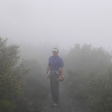
We plan to run Los Pinos trail this Sunday.
Los Pinos is the only trail marked as strenuous on the map of that area: even infamous Holy Jim is called "moderate to strenuous".

Distance: 8.2 miles (one way or 16.4 miles overall)
Difficulty: Strenuous
Net elevation gain: 3,300 feet
Access: The upper trailhead is on North Main Divide road 5.8 miles from Ortega Highway (Hwy 74). The lower trailhead is in Hot Springs Canyon, 1.5 miles beyond the San Juan Fire Station off the Ortega Highway on the Lazy W Ranch.
Map of the area:
http://www.fs.fed.us/r5/cleveland/recreation/trails/non-wild-trails.pdf

As I had some questions about directions to the trailhead, I asked OCTR about it. I guess even if I announced I wanted to do Badwater without any support and right after that run back to the start line where I planed to park my car, it would cause less response than my question about our little Los Pinos run this Sunday.

In a word, I never remember being so nervous before a training run. I guess I was less agitated even before my first marathon or my first ultra. As I am trying to pull myself together, I decided to publish most interesting answers in my blog for the next rookie that might dare to challenge Los Pinos after me (and in case I do not manage to come back from there):

Greg Hardesty

Go straight to Hell, take a quick left at Hades, then a right at Eternal Misery, and finally you will arrive at the cul-de-sac locals refer to as Complete Agony. Have fun.

It's up and down, up and down, on pretty technical, overgrown singletrack. Bring lots of fluids and food. It seemingly never ends. Don't do it alone. It's in one of the most remote areas of the Santa Ana Mountains. Awesome views, if you can see through your tears. If I had to pick a worse fate, it would be being forced to watch a season-long DVD of "Grey's Anatomy" or "Scrubs." Los Pinos is the kinder of the options.

The Los Pinos trail snakes up and down (and I mean up and down) on the spine of a ridge, starting at about the 4,200 level and eventually ending somewhere in the high 100s. There are steep ascents and descents too numerous to count. Most of the trail is on loose dirt and rock, and portions are seriously overgrown, making it a very technical challenge (or nightmare -- again, depending on your mood).

Here is the full recap of Greg’s first acquaintance with Los Pinos trail:
http://achtungrunner.blogspot.com/2007/10/rite-of-passage.html

Keira Henninger

Robo and I did Option #2 and added 20 miles on the San Juan Loop trail for one hell of a run the other weekend, and it was awesome! It took Rob and I two and a half hours to climb it (8 miles), and we were freaking pushing it and ran the whole thing (no I am not kidding).

Sunday is gonna be warm and I swear this trail is gnarly! Bring lots of water (camelbacks are a must). It is exposed, very steep and just down right rocky and tough, but by far my favorite trail anywhere! You can also hit it off the bell ridge trail, or from Blue Jay take Main Divide. I have done a few different loops using Los Pinos, and never once has it been anything but a bear!

Kirk Fortini

Dmitri, I'm only echoing what's already been said, but this trail's the real deal. If you find yourself looking up, and you see another trail segment that you sincerely hope you don't have to climb, chances are that's where you're headed. There's more up and down than I can find a comparison to (at least not one that's not ribald).

I guess that in its own way, Pinos is just one of those trails that exposes your weaknesses in a manner that sort of sneaks up on you as the miles progress. Everyone that traverses it has their own impression of the thing.

It, as with any particularly difficult trail, demands of you a high level of humility. When at last you finish, if you think that you've conquered Los Pinos, take a look back over your shoulder. It will still be there, very much unconquered, waiting for the next runner. The only thing that will be conquered would be your own body, tired from your efforts. So, approach your run with the idea that, though challenging, the strenuous nature of the trail will be your silent companion on a path of personal strengthening. Win, lose, or draw, you will discover that you are only human after all.

Nietzsche: "That which does not kill us, makes us stronger."

Charlie Nickell

Be very conservative for this run. If it's really hot, I would bag it. We kid around but if something happens to you halfway up Los Pinos, you're in serious trouble; there’s no relief and no easy way out. BE CAREFUL and SMART. I've seen seasoned runners get absolutely crushed by this trail so hit it first. Eight miles of hell. Make sure you’re will is in order.

Chris Diaz

How to get to Los Pinos Trail? - Train, Train, Train!

The only time I did this trail, I found myself questioning the meaning of life.
Just Run It. What could happen? Bring lots of water and fuel.