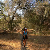
We parked on San Juan Meadows parking lot of the Caspers Wilderness Park at about 7am today. This place is right off Ortega Highway on the left-hand side of the road when you drive inlands from Orange County.
We started our run on Juaneno trail. The first 2-3 miles of the run were pretty flat. Half of the trail was covered with a deep dust or sand, and it felt like running on the beach – great cushioning but it slows you down considerably.
Right after we turned onto San Juan Creek trail we hit a steep climb where Linda and I had to switch to walking, while Andy just kept running managing to keep the pace we had on the flat sections. I do not hate ascents – I am just not good at handling them. Downhill running is so much more fun!
We turned on Hot Springs Canyon trail and reached the hot springs pretty soon after that. It was around 5 miles from where we parked this morning.
Few facts about the hot springs for those who have not been there yet:
1) They are actually hot - not Starbucks-coffee-hot - but at least bath-tub-hot. So it is not a figure of speech as I kinda expected :)
2) They are bubbling and there is even actual steam coming up from the water despite it was already getting pretty hot when we reached the springs
3) They are reserved for trail runners only - you can only access them if you trail-run or do long-distance hiking. They are pretty close to Ortega highway, but completely fenced and surrounded with “No trespassing!” signs all around. However all the fences and signs face Ortega and if you get there from the hills side it does not feel like you do anything wrong at all :)
This is the infamous vampire photo of me Linda made in the Hot Springs area. Linda could clearly see me standing there - but when she was looking at me through the camera viewfinder she saw an empty spot right where I was supposed to be. Andy mentioned that this phenomenon is pretty natural for the vampires in the day light and works alike with any optics whether this is an ordinary mirror or a camera :)
After that we ran Cold Springs trail and turned on Oso trail that goes on top of the mountain ridge - it is one of those trails where you are getting a very spectacular view down on both sides of the trail at the same time. We could see from it Coto de Caza with the estate of William Lyon in the middle of it.
The downhill on Oso was pretty breathtaking. We went down from around 1650 feet to 550 feet within just a mile or two miles tops. I tried out again that thing I read in Scott Jurek’s interview from TrailRunner Magazine few weeks ago: no leaning back on the downhill - just relax, shorten your stride and run as fast as you feel comfortable running. And fast it was :)
Finally we turned on Bell Canyon trail, than Oak trail, passed by the horse stables and windmill and reached the parking lot with Linda's truck and cold Gatorade in it!
A genuine footprint of a genuine mountain lion. We have not see a lot of those prints on the trails though - they were more spotted by deer, runners and mountain bikers.
According to the information from the rangers’ post the last sighting of a mountain lion in this area was at July 24, 2007 (or was it June 24?), while the last sighting of a mountain biker was about 5 min before we came there.
Mileage: 13.5 miles
Time: 2:51:00
Average pace: 12:40 min/mile
More photos from the run (63 photos):
 |
| Caspers Wilderness Park |

1 comment:
you are a picture maniac! And I thought Greg and I were bad ;) Great pics! I still have NEVER run in Caspers. I really need to get out there soon.
P.S. That turn you guys missed was about .5 mile BEFORE you got to the OSO bridge :) The turn is from the Trabuco Creek Trail that we were on to the Tijeras Creek Trail which runs past my house and all the way up past the main Coto entrance off Antonio.
Post a Comment